Showing posts with label Karcham. Show all posts

Friday, 7 November 2014

Chapter --- (5), Hindustan-Tibet Road fantasy. (July-August) 2014

Continuation of previous chapter of my Blog . 
Chapter --- (5)

Our today’s journey would be From Sangla ---- Rakcham --- Mastrang Chowki (here there is an ITBP Check Post) --- Chitkul ---- Back to Rakcham ---- Back to Sangla ---- Back to Karcham ---- Powari (To go to Rekong Peo, here we have to take a detour) ---- Rekong Peo 

(Day-4) 19th July 2014:--- Today morning after refreshing ourselves with our natures morning chores, we packed our luggage and loaded it into our car boot. After vacating and settling the hotel room bill, we walked upto a near by road side Tea stall that was named as “Suresh Dhaba“ Here in this small shack we had plentiful hot and tasty breakfast.

 Suresh Dhaba
Early morning view at Sangla village


After the filling and generous breakfast, we left Sangla Village round about at 8.00 AM.and drove towards Chitkul (4550 mt ASL) that is about 14 kms away from Sangla. Chitkul Hamlet is at the Indo-Tibet-China border and is the last village of this Sangla Valley area. It had been raining torrentially and the whole area was completely engulfed with thick grey blanket of Fog.


Foggy Road to Chitkul
Foggy and deplorable Road to Chitkul
The Fog was so thick that we could hardly see the road beyond 5-feet distance. Even though we had kept our car’s “Head- Lights-ON”, but still the visibility was very, very poor. In this torrential rain, we were driving at a snail speed. Because of dilapidated road, our car was practically wobbling, hopping, tossing, stalling and practically crawling towards Rachcham and Chitkul.


Above Scenic pictures are around Rakcham and it's surroundings.
(Population of Rakcham village is approximately (850)
Somehow we managed to pass a village called Rakchham which is 10 Km from Sangla and is at an elevation of (10,000 ft) above MSL. This small village has a beautiful picturesque scenic view and has other than many private hotels,  a brick and cemented government guest houses for tourists to stay. It’s so scenic that lot of Bollywood movies had been shot here. The whole surroundings are so awesomely amazing that it looks something like as scene from a fantasy world.


Chitkul  Scenic view
After Rakchham, with lot of difficulties of crossings couple of unpredictive boulders filled, “Nalas” (Stream Crossings), some how we managed to reach at “Mastrang Chowki” which is situated at an altitude of (12,500 ft) above MSL. It is only 4 Km before Chitkul. It’s an (ITBP Check Post), which is always manned by the ITBP Army personals. One of the ITBP Jawan was guarding this post in freezing cold and torrential rain. I came out of my car and saluted that Army Jawan and loudly wished him “JAI HIND”  Because of the loneliness, he looked so frustrated,  damp and dull and bored. But suddenly there was a big smile on his face, when I wised him “Jai Hind”. He too proudly reciprocated by saying “JAI HINDH” After checking and entering into a register book, the details of  our personal identity documents as well as our car documents, he sincerely suggested us that since it had been raining nonstop.  There may be sudden flash floods. As per his personal past experiences, because of Nalas flash floods, there were very good chances of getting this road cut off and  blocked partially or completely, for a week or two. So he suggested us that since it had been raining nonstop heavly from last couple of days we wouldn’t be able to see anything around Chitku and it would be wise that we turn back and go back to Sangla. More over every inch of the Chitkul area would be completely engulfed and covered by the blanket of thick Fog and heavy clouds. Understanding the severity of the situation, we listened to ITBP Jawan’s sincere advice. We immediately drove back to Sangla. Later in the day we came to know that Chitkul road had been cut of due to heavy landslides. In our prayers we thanked that ITBP Jawan for his concerned advice. 

Old Temple at kamru 
We reached back at Sangla at about 10.30 AM. We decided to drive down straight  to “Reckong Pao”  town, which is about 62 Km away. To go to “Reckong Pao” we had to drive back first to Karcham village and  then drive on NH-22, towards Powar village, which is situated at an altitude of (8,736 ft) above MSL. To go to “Reckong Pao”, at Powari we had to take a detour on the right side of NH-22 which goes straight upwards towards “Reckong Pao” and Kalpa village

Chitkul Village

“Chitkul, is also known as the Crown of Kinnaur valley”

Chitkul is situated at an altitude of (11,320 ft) above MSL.
 Population of Chitkul village is approximately (583)

Until 1989 outsiders could not enter this valley without a special permit from the Government of India, due to its strategic location, on the Indo-Tibet-China border. Even today to enter Chitkul, every one has to show the details of His/Her ID documents at Mastrang Chowki ( ITBP check Post) and only after the verification, is allowed to proceed furthet  to Chitkul.   

Brief Introduction of Chitkul valley
Due to its steep and difficult mountainous terrain and very cold climatic conditions, this region is quite remote, underdeveloped and thereby not much visited by tourists? In fact Kinnaur district comes under the tribal zone of [HP] and the rural inhabitants are given special attention and special privileges by the government of [HP], for the upliftment of their living standards. The remoteness of the region probably is a boon in disguise as the spectacular beauty of the nature, it by and large possesses, is still virgin and not yet spoilt by the influx of hordes of flocking tourists.

 "Chitkul " is the last in-habituated village on old Hindustan - Tibet Road. It is situated at an altitude of 3450 Mtr. [11,345 ft.], which makes it the highest village of Baspa Valley of Himachal Pradesh. The River Baspa originates from the snow-mountains of Chitkul and flows through Chitkul towards next village "Rakchem" The latest census indicates, that the population of Chitkul is 583.  Its location is marvellous from point of view of Nature's Beauty. Snow covered mountains from all round, with lush green forests and River Baspa flowing through the Village. The wonderful charm of nature, at its peak, is around mid-March, when snow is not troublesome for approach to this remote point and simultaneously you get snow everywhere around you to enjoy. The nature's charm of " Chitkul" like any other outstanding place] has to be seen to appreciate it. Both " Chitkul " & " Rakcham " are nice places for trekking and fishing in river Baspa. During summer time one can enjoy " Igloo Nature Camps " near Sangl. There are 3 temples of local Goddess " Mathi" here. The main temple is said to have been made 500 years ago. Great Pagoda " Kagyupa Temple " has old image of " Sankyamuni Buddha" Sangla-- Rakcham is 10 Kms pleasant drive and Rakcham-- Chitkul is 14 Kms highly picturesque drive, along the mountain-river Baspa. This drive is one of most memorable drive. I have never seen a stretch, scenically more beautiful than this 14 Kms. It cannot be described in words. It has to be seen with one's own eyes to believe it. Mind you anyone and everyone would love this serine, calm, peaceful and meditating mountainous small hill retreat.

Few places of tourist interests are

Kamru Fort:-- About 2-3 KMs away from Sangla Valley, there is a famous 1000 year old Kamru Fort considered to be one of the oldest forts in Himachal Pradesh. Do check out when you are in Sangla Valley.


Kamru Fort on the way to Chitkul
Kamru Temple on the way to Chitkul
Misc. Trails & Meadows around Sangla:--- There are loads of trails in these apple orchards which can be hiked around while your stay in Sangla Valley. There are some lovely meadows too (one near Rakcham village as I remember) as well which can be visited or spent time to bask in the lap of pristine mother nature. 

Batseri village to Sangla Village  :---- 

Distant View of Batseri village. 
Sun set @ Batseri. 
Old Temple @ Batseri


Devta Shri Badri Narayan ji and Devta Shri Vishnu Narayan ji at Batseri village,Sangla.
walk of about 12 KMs through dense Cedar forests is also quite famous among people who love being midst nature and actually feel it. There is a Trout Fishery Farm on the other side of Baspa River near Sangla Village too which is nice to visit and can be covered in this walk itself. What better having a trout for yourself and later barbecue it over camp fire in the evening.

Now showing a series of pictures regarding the deplorable road conditon (through which we drove) of NH-22, from Rakcham to Powari village.


Deplorable condition of road from Karcham to Powari village


POWARI  VILLAGE
Powari is situated at an altitude of (8,500 feet) above MSL.
Aproximate Population of Powari village is (1,000)

 From Sangla we reched “Powari Village” via Karcham. Powari is about 45 Km from sangla. At Powari there is a "Y" junction at Nh-22, where one leads to Poo and Kaza  and the other leads to Rekong Peo and Kalpa.


Powari Village on NH-22 
At Powarin we took a detour on the right side of NH-22, that leads steep upwards to Rekong Peo town. Rekong Peo town is about 6 Km from Powari junction. 


RECKONG PEO
It is situated at a height of (7,513 ft) above MSL.
It’s, 260 Km from Shimla. It’s population is about (7,500) people

As soon as we reached Reckong Peo town we visited the Tourism Dept information center, which is at the entrance of the town itself and we collected Himachal tourism brochures from Himachal Touriism office and more over inquired and collected information regarding our further onwards journey.

Reckong Peo is a very hustling and bustling town with full of activities of daily chores. The locals from this town as well as nearby villages were busy buying required house hold stuffs, medicines, clothes and other required grocery stuff for storing for the rainy days as well as for winter season. The government officials were buys with their day to day official work. In this town there are district administrations offices such as DC office, SP of police’s office, Degree College, full fledges Hospital and the town is full of Hotels who cater to the needs of the tourists. The whole town is swarming, crowded, busy and noisy.

Reckong Peo, is simply known as Peo by the local inhabitants. It is headquarters of Kinnaur district. Reckong Peo is named after a community of people who used to own this place in ancient times.

Earlier Kalpa was the headquarters, but later it was changed to Reckong Peo. 


From Powari, entrance to Rekong Peo Town. 


Main street of Rekong Peo.
One of the government Official Buldings
 Main taxi satnd  area at Rekong Peo
Brief History
Reckong Peo came into existence on 1st May 1960. In accordance with history, it is believed that it was earlier known as Kinnaura. There are many legends and myths attached to the history of the district. In between, the 9th and 12th century the district was under the rule of the Guge Kingdom of Tibet. After that, it was divided into seven parts, which jointly came to be known as Sat Kund.

The district was later conquered by Akbar, which resulted in the insertion of this district into the Mughal Empire. After the fall of the Mughal Empire, this district was then known as “Chini Tehsil” which played a vital role in the progress of the region.

Reckong Peo is the capital of Kinnaur District. It is one of the twelve administrative districts of Himachal Pradesh. It is at an altitude of 2,290 meters above mean sea level.

Summers in the town of Reckong Peo are very moderate, and this is the finest time to visit the town of Reckong Peo. However, the winters are too cold.  The maximum temperature in this time will range nearly (25°C) and the minimum temperature remains nearly (-10 °C). The best time to visit Reckong Peo is from March to June and from September to December.

A brief introduction of places to visit in Reckong Peo

(Chandika Temple)


Chandika Temple

Chandika temple is perched at a distance of nearly 3 kms away from Reckong Peo, Chandika Temple is dedicated to deity Chandika.

“Khab” –


 Road to Khab. 

 Khab Village
It is 2831 m from Reckong Peo. Here River Spiti confluences with River Sutlej. A little bent from here takes one to Tashigang Gompa. 

“Kalpa”-- 

Pictures of Kalpa Village


Kalpa is a small hamlet at an elevation of 2960metres in Kinnaur district of Himachal Pradesh. This place is at a distance of 13 kms from Reckong-Peo. From Kalpa we can get views of three peaks: Jarkanden (6473m), the Kinner Kailash (6050 m) and Roldang (5499m).

Places to Visit Around Reckong Peo district

Bhaba Valley - Bhaba valley is known for its thick forests and lush green flower scattered meadows. It serves as a perfect base for trekking to the various regions situated close to the valley. 

Kinner Kailash - 

Majestic Panoramic view of Kinner Kailash from main Hindu temple and adjusant Buddhist Monastery at Kalpa


Kinner Kailash mountain Peak is (21,386 ft) above MSL.
 Kinner Kailash is a mountain range in Himachal Pradesh, at an elevation if 6500 mts above sea level and is revered by both Hindus and Buddhists. It's very difficult to reach Mount Kinner Kailash. 

Chango – 

Distant view of Chango Village. 

Main entrance gate to Chango village
It is 123 kms from Reckong Peo. Chango is famous for the quality of its apples that grow in its dryness and low temperature.

Leo – 
Leo is a small village with an old temple dedicated to the local deity, Tangtashu. It is 105 kms from Reckong Peo.

Kanam – This village is famous for its beauty, Buddhist Monastery, local deity Dabla-shu etc. 

Moorang –It is 33 kms from Reckong Peo. It is an attractive village with apricot orchards all around. There is an archaic fort in Moorang which is believed to be built by Pandavas.

Ribba – It is 23 kms from Reckong Peo. It is famous for it's vineyards, orchards and the local wine ‘Angoori’. 

Pooh - 

Distant view of Poo village
The main attraction of Pooh is a Buddhist temple dedicated to Sakyamuni or Lord Buddha

Nako – 

Aerial view of Nako Lake.  

Panoramic view of Nako village
It is well-known for Nako Lake and Monastery.

My this Blog to be continued in the next chapter


Blog Link of my previous chapter--(4)
http://ashokparimoo.blogspot.in/2014/11/chapter-4-hindustan-tibet-road-fantasy.html

Saturday, 1 November 2014

Chapter --- (4), Hindustan--Tibet Road fantasy (July-August 2014)

Continuation of (Guruduth Kamath & Ashok Parimoo) “Trans Himalayan Hindustan-Tibet Road” fantasy.

Chapter— (4)
Bhavnagar ---- Wangtoo ---- Tapri ---- Urni ---- Chaling ---- Karcham --- Sangla 

 (Day 3):--18th July 2014:--- Next day morning at Bhavnagar, after a deep sound sleep, we got up leisurely by 8 AM. All night along it had been raining continuously. After hot water bath we packed up our luggage and reloaded it into our car and then drove straight on a steep up-ward gradient road that leads straight right upto the main market of Bhavnagar, at NH-22. Here we stopped for our breakfast. We entered into a small road side tea stall called as “Krishna Tea stall” In this tea stall there were two teenage girls who were helping their father to make “Moo-mos” Guruduth clicked series of pictures of the whole process of how to make “Moo-mos”. It was interestingly fascinating to see how effortlessly and efficiently they were making these Moo-mos.


At the tea stall we ordered Moo-mos, aloo parothas and hot milk for our breakfast. It was hot,  tasty, refreshing and filling breakfast..

After the breakfast we rearranged the luggage of our little “PEGASUS--ALTO”, (In Greek mythology “Pegasus” is the white immortal flying horse). While we were busy reloading our car, most of the Locals, out of sheer curiosity inquired from us, where were we heading to? As we told them that we were going to Leh-Ladakh via NH-22. In disbelief  their mouths opened wide and their heads shook repeatedly, in negative gesture saying “Oh No”, not possible? Then they warned us about the seriousness of the condition of the treacherous road ahead of us. It was not only the tough deplorable road condition, but it was also that the clearance in between the low-chassis of our Alto car and the deplorable road was a very serious concern and was also a very serious problem. All of them advised us that because of the low clearance of the car and big boulders on the road ahead, our car would definitely break down somewhere on the way. Most of them suggested us that it was wise we turned around and went back via Kullu, Manali, Rohtang, Leh Road. After paying little heeds to their sincere advise, like big fools,  we decided to continue driving on NH-22 itself.

Though it was still foggy and raining, but we had not choice other than just continue driving up on our further journey. Our today’s further journey would be from Bhavnagar till Sangla village. Today’s night we would be staying at Sangla village.

From Saharan village, the Kinnaur district starts

Brief Introduction of “KINNAUR DISTRICT”

Kinnaur District is the one region of Himachal Pradesh, which faces one of the most dreadful torrential rains. And the main cash crop of the whole district is “Apples”. Because of the sweetness, crispness and the juiciness “Kinnauri Apples” fetch three times more cash than the apples from the rest of Haimach Paradesh.

The Father of Apple cultivation in Himachal Pardesh, is “Samuel Evans Stokes” alias “Satyananda Stokes” (16 August 1882 - 14 May 1946). He started apple cultivation in 1916 at “Kotgarh & Thanedhar” 17 Km from Narkhand

Young “Samuel Evans Stokes(16 August 1882 - 14 May 1946)
He was an American who settled in India and later participated in the Indian Independence Movement. 

He is best remembered today for having introduced to the Indian state of Himachal Pradesh, where apples are today the major horticultural export crop.


In 1904, aged 22, Samuel came to India to work at a Leper colony located at “subathu” in Shimla.
In 1912, Samuel married a local “Anglo-Indian” Rajput girl, purchased a chunk of farmland near his wife's village and settled there. His wife, Agnes, was the daughter of a first generation Rajput Christian. Samuel's father had settled a considerable fortune upon Samuel, and the purchasing power of this inheritance was magnified manifold in the remote, beautiful part of India where he settled.
Samuel and Wife Agnes with the First Born.The family grew with the birth of five children.
Samuel applied himself to improving the farmland he had purchased and was able to access scholarly resources unknown to the other villagers in this endeavor.   identified a new strain of apples developed by the Stark brothers of “Louisiana”, USA as being suitable to the “Shimla Hills” and began cultivating them on his farm. This was in the year 1916. The resulting bumper crops, coupled with Samuel's access to the white people who ran the export business in Delhi encouraged the other farmers also to do as Samuel was doing, and he helped them wholeheartedly in every way. Indeed, he purchased more land and devoted it to growing apple cultivars which the villagers would use to seed their own farms. The local economy was vastly reinvigorating.


After Hinduism the couple was called as "Satyananda" and "Priyadevi".
This happy idyll was shattered with the loss of his son Tara to amoebic dysentery. He moved closer to Hinduism and a few years later in 1932 he converted to Hinduism, taking the name "Satyananda" while his wife Agnes also changed her name to "Priyadevi".


Samuel alias "Satyananda"
Stokes had always had a strong sense of social justice and later became active in India's freedom struggle for independence from Great Britain. Stokes had the rare honour of being the only American to become a member of the All India Congress Committee (AICC) of the Indian National Congress. Along with “Lala Lajpat Rai”, he represented Punjab. He was the only non-Indian to sign the Congress manifesto in 1921, calling upon Indians to quit government service. He was jailed for sedition and promoting hatred against the British government in 1921, becoming the only American to become a political prisoner of Great Britain in the freedom struggle. 


On Stokes’ arrest, Mahatma Gandhi wrote: “That he (Stokes) should feel with and like an Indian, share his sorrows and throw himself into the struggle, has proved too much for the government. To leave him free to criticise the government was intolerable, so his white skin has proved no protection for him.
He died on 14 May 1946 after an extended illness shortly before Indian Independence.

It’s just a brief introduction of Kinnaur district, about its important towns, culture, people, religion, their heritage, customs, traditions, and the life styles of its people.

Important towns of Kinnaur district are Nichar, Sangala Valley, Kamru, Chitkul, Powari, Recong Poe (District Headquarter), Moorang, Pooh, Nako, Changho and Leo.

Kinnaur district produces of the finest qualities of apples which fetch three times more price compared to the rest of Himachal Apples. Other fruits produce in this district are almonds, dried apricots, locally called as (Chulis), grapes, raisins, chilgoza (Chestnut), grapes, beans, Jeera (spice) and Saffron.
Kinnaur, surrounded by the Tibet to the east, is in the northeast corner of Himachal Pradesh, about 235 km (146 mi) from the state capital, Shimla. It has three high mountains ranges, namely,  Zanskar, Himalayas and Dhauladhar that enclose valleys of  Sutlej, Spiti, Baspa and their tributaries. The slopes are covered with thick wood, orchards, fields and picturesque hamlets. The much religious Shivling lies at the peak of Kinnaur Kailash mountain. The district was opened for the outsiders in 1889. The old Hindustan-Tibet Road  passes through the Kinnaur valley along the bank of river Sutlej  and finally enters Tibet at Shipki La pass.

It is not only the scenic beauty which appeals to the young and old alike but also the life styles of the people, their culture, heritage, customs and traditions. The people have strong culture and beliefs, generally follow Buddhism and Hinduism, believing the Pandavas came and resided in the land while in the exile<kamru village. Thousands-year-old monasteries still exist in the area. Buddhists and Hindus live in harmony symbolising the traditional brotherhood and friendship of the people of both the faiths. The high terrain here facilitates adventures and sports. Trekking routes include the 'Parikarma of Kinnaur Kailash'.
The people:---

The present day Kinnauras do not constitute a homogeneous group and display significant territorial and ethnic diversity. For a better understanding of ethnic and cultural distribution, Kinnaur district may be classified into three territorial units. 

Lower Kinnaur comprise area between Chora at the boundary of the Kinnaur district with Rampur Bushahr and Kalpa including Nichar and Sangla valleys. The people of Lower Kinnaur are primarily of the Mediterranean physical type. It is difficult to distinguish them from the people residing in the adjoining Shimla district with whom they have some affinity. The people of lower Kinnaur are mostly Hindus though the ethno-historical factors have resulted in growing Buddhist influence.


Ethnic Lower Kinnaurie People


The middle Kinnaur is the area between Kalpa and Kanam including Moorang tehsil. The people of middle Kinnaur are of mixed racial strain. Some have marked Mongoloid and others marked Mediterranean features. In some cases there is an admixture of the above two in varying degrees. The inhabitants are Buddhist as well as Hindus. Many people have faith in both the religions. It is very common to see Buddhist flag in most houses.


The upper Kinnaur comprises remaining north-eastern part of the district i.e. the area between Poo (Town) and Hangrang valley extending up to international border with Tibet. The predominant physical type of upper Kinnaur is the Mongoloid though a few persons with Mediterranean features are also seen in the area around Poo. Some persons show the blending of Mediterrean and Mongoloid elements in varying degrees. However the people of Hangrang valley are almost universally Mongoloids. They mostly follow Mahayana Buddhist religion.


The Kannaurs are very fond of music, dance and singing.

The Kinnaur society is divided into two broad occupational groups- peasants and the artisans possibly of diverse ethnic origin. These groups are represented by Gujjars and Kanet Rajputs and Schedule Castes. The Kanets comprise the main cultivating community of the area and use honorific surname Negi. Among the Kanets there are three grades. In the first grade Kanets there are as many as fifty sub-castes, in the second grades there are seventeen sub-castes and in the third grade who work as potter have three sub-castes. Waza Kanets belong to the third grade and are considered inferior among Kanets. There are two Scheduled caste groups based on the occupation. One group traditionally make and wove clothes whereas the others are primarily blacksmiths. There is a third caste called who are carpenters. The main profession of Ores is carpentry. In social status the Ores are equal to blacksmiths. Among the scheduled castes blacksmiths and carpenters considered themselves superior to Weavers.

Languages
Both regional as well as social difference have influence on the linguistic climate of the region. A typical village is a mixture of Rajput, Blacksmiths and Carpenters, and all three speaks separate languages. The regional difference in language is spectacular - out of the total nine languages spoken in the district, six are regional differences and two are social varieties. Seven out of nine languages belong to Tobeto-Burman language family whereas the two caste languages belong to Indo-Aryan language family. All of these languages are predominantly used in the communication at home. It is quite common to hear the people speaking in their own language even In Reckong Peo, the district headquarters.
Buildings in Kalpa show strong Hindu and Buddhist influence.

The people of lower Kinnaur are largely Hindu. Their most important gods and goddess are Durga (Chandi), Bhairon, Usha (Ukha), Narayan, Vishnu, Badrinath and Bhimakali. The Blacksmiths and Carpenters have their favorite deities such as Nag Devta. In addition, each village has its presiding deity.

The inhabitants of middle Kinnaur are Buddhist as well as Hindu. The important Hindu deities of middle Kinnaur include Chandi, Gauri Shankar, Kansa and Narayanjee. Dabla, the local god of Kanam village, has certain features traditionally associated with the Bon religion. The image of Dabla is installed along with those of Buddha and Guru Rinpoche (Padmasambhava) in one of the monasteries at Kanam.

The religion of upper Kinnaur is mostly Tibetan Buddhist. Almost every village has a monastery with monks recruited from amongst the (Kanet).
Buddhism is the main religions in the district followed by Tibetan Buddhism, Bon is not practiced but some are mistakenly or bought by money. These three religions have undergone religious mixing, along with some indigenous shamanistic practices. One can see some Buddhist influences on the Hindu religion in Lower Kinnaur, the mixing of Buddhist and Hindu beliefs in varying degrees in Middle Kinnaur, and even the influence of Hinduism on Buddhism in Pooh of Upper Kinnaur. However, Buddhist Hangrang remains largely untouched by Hindu influence.

One can see Hindu gods being worshipped side by side with Buddhist deities in Buddhist and Hindu temples, especially in Middle Kinnaur. Dabla, one of the major Bön deities, is greatly revered by the Kinners in the area. Folk Hindu gods are also worshipped in Middle and Lower Kinnaur. These include the Durga (locally known as Chandi, Narayan, Vishnu) and many other folk Hindu–animist gods. Folk deities play a major role in the daily life of the Kinners.
Superstitions concerning animist ghosts such as Banchir, Rakshas, and Khunkch also play an important role in the belief system of the Kinners. Pujas and horns of domestic animals are used to ward off the evil spirits, in order to bring good luck.

Buddhist Lamas play an important role in the daily life of the Kinners, and young monks of Upper and Middle Kinnaur are trained from a young age in conducting religious ceremonies, devoting their lives to Lamaism and learning to read Tibetan scriptures and Buddhist doctrines. When they become Lamas (male monks) and Chomos (female nuns), they are given religious duties, which include presiding over the religious and secular affairs of the Kinners. They are generally divided into two groups, namely, the celibate Gyolang, who shave their heads, and the non-celibate Durpu, who do not shave their heads.

The Kinner Kailash is the most sacred mountain for most Kinners. Every year it is visited by thousands of locals on religious pilgrimages known as Yatra, Hindu and Buddhist alike.

Flora and fauna


Portions of Kinnaur are situated high in the Himalaya, where vegetation is sparse and consists primarily of hardy grasses. Alpine species such as Juniper, Pine, Fir, Cypress and Rhododendron can be found at elevations between 3,500 and 5,000 metres, primarily in Middle Kinnaur. At lower altitudes, temperate-climate trees are found, including Oak, Chestnut, Maple, Birch, Alder, Magnolia, Apple and Apricot.  

Jeera Spice and Plant (also called as Cumin spice)


Pine Cone
Chestnut Fruit and above is the picture of a branch of chestnut Tree Chilgoza nuts which comes out of Pine cone; shown above in the Picture


Chestnut Fruits and above is the picture of a branch of chestnut Tree

Green Almonds  
Apricots  


Rain Soaked Apples


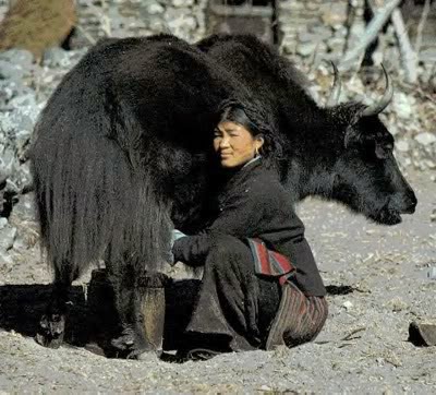
Yaks and Dzos are reared by local farmers in the higher areas. Scattered populations of the Himalayan Black Bears and small Ponies may also be found.


Petrol Pumps near Kinnaur Valley
About 10 KMs from Kalpa, you can find the nearest petrol pump at Reckong Peo. There is one more fuel pump at Powari which is on Hindustan-Tibet Highway. Most of the time the fuel pump at Powari was not functional. On NH-22 at Tapri highway itself there is one fuel pump which is fairly new.
Best thing is to top up your fuel tank at Narkanda which is fair in terms of quality as well OR the last petrol pump in Rampur that comes on the right side while going from Shimla side.

ATMs near Kinnaur Valley
There is an ATM as far as I know in Sangla Valley. Otherwise, you may find one for sure at Reckong Peo about 8 KMs away from Kalpa and 38 KMs away from Sangla

SANGLA VALLEY

Sangla is situated at an altitude of (9,000 ft) above MSL

Day(3):-- 18th July 2014:---Today’s from Bhavnagar village, on our further onward journey, we would be travelling on the rough portion of NH-22. From here onwards we would be climbing upwards throughout the most deplorable snake like winding road of Wangtoo, Tapri, Chaling, Karcham and finally Sangla. Our today’s night stay would be at Sangla village.

At “Wangtoo” - The Karcham Wangtoo Hydroelectric Plant is a 1,000 megawatts (1,300,000 hp) on the Sutlej river in Kinnaur district. 


The dam and power station are located between the villages of Karcham and Wangtoo, where the plant also gains its name. Jaypee Karcham Hydro Corporation Limited. The construction on the power station began on 18 November 2005.The first generator was commissioned in May 2011, the second in June and the final two in September 2011. The (322 ft) tall dam at Karcham diverts a substantial portion of the Sutlej into a 10.48 m (34.4 ft) diameter and 17.2 km long headrace tunnel to the underground power station downstream at Wangtoo. At the station, the water powers four 250 MW generators before it is sent back into the Sutlej via a 1.2 km long tailrace tunnel. Water not diverted by the dam is sent over the Spillway and down the normal course of the river. The main spillway is along the crest of the dam and is controlled by six redial gates. Just upstream of the dam is the 300 MW Baspa II Hydroelectric Plant and downstream of the Karcham Wangtoo is the 1,500 MW Nathpa Jhakri Dam.  

At “Tapri”:--- Here we filled our car’s Petrol tank to full capacity.


In between Tapri village and Chaling village, NH-22 was blocked due to heavy Landslides. These two villages are just 4 Km away from each other. But to avoid 4kms of Landslide area, all vehicle drivers had to take 25 Km detour road through Urni village, which has very steep gradient and is very narrow with only mud road which are full of potholes. From Tapri side, first we had to climb up for about 15 Km to reach Urni village and then drive down the steep slops for another 10 km to come and join at Chaling. Since only one way heavy vehicles traffic was allowed, but still we took nearly more than one hour just to cover 25 Km. One way traffic was controlled by Police as well as BRO staff.


On the way to Tapri Village Electricians were repairing the high voltage electric lines
“URNI” Village
Urni  village is situated at an altitude of (4,760 ft) above MSL.
Urni though is a very small village, but mind you it has mind boggling landscapes, scenic beauty and awesome natural surroundings which are so soothing to eyes that it feels blissful. In Himachal Pradesh, Urni is one of the most devastatingly worst effected landslide areas. 


Most dreadful road leading from Tapri village to Urni village
After “Chaling”, “karcham” is 4 Kms away. “Karcham” holds a Hydro Electric Dam by Jeypee Indusries which produces 500 MW of power. 


At Karcham
To go to Sangla Valley or also known as the “(Baspa Valley)”, we had to take a diversion towards right side of the road  from Karcham which is at “Hindustan Tibet Highway” that goes further onwards towards “Kaza” from Shimla. The distance from Karcham to sangla is about 16 Km. 


view of opposite village while climbing steep road from Karcham towards Sangla village
It’s  very steep climb and the road though is moderately good, but is very narrow and is full of blind curves and bends where we see nothing beyond the curves. For the first time drives like me, it’s very dangerous drive and we had to drive very carefully and slowly. One mistake and we would be tumbling down through deep gorges and would be plunged deep into furiously flowing river Baspa. Later they would have had to pull out badly mangled car and our carcasses only.

Important :--- Please you must go through this Video Link. This shows that how dangerous road it is that Guruduth and I,travelled through. "This road is called as THE "ROAD TO HELL" 

https://www.youtube.com/watch?v=skC8u4Ok0Kg 

in case if this link does not work please copy the Link and paste in different window.


Finally at about 3 PM we reached Sangla town. Since we were dead tired and very hungry, the very first thing that we did was that we straight went in to one road side small eating joint and had hot Muttter-Paneer, Daal, Chawal for lunch. Then we started, room hunting for our night stay. The PWD guest house was full and then finally we managed to take a room for the night stay at a nearby hotel named as “Ashiana Guest House”. First the manager of the hotel at the counter told he would be charging Rs. 700/- per night. Since it was a rainy season that means it was off season, after lot of coaxing and bargain, somehow we managed him to agree for Rs. Rs. 400/- Once we settled down in our  hotel room, it started raining heavily and continued raining whole night through. In the same evening itself, in the rain itself we drove down across the river Baspa to visit “Trout Fish Farm”, which is on the other side of river Baspa. And once we came back from “Trout Fish Farm”, we went to visit "Snake-Temple" called as Bering Nag Temple. Just adjacent to the temple, there is a "Buddhist Monastery" too.


Bairan-Nag Temple ans Buddhist Monastery at Sangla
In the night we had dinner at a Tibetan Cafe and had hot soup, moomos and Chowmein.

Since we realized that wherever and wherever we take hotel rooms for our night stays. There wouldn’t be more than one or two electrical plug-points in any rooms, where we could plug in for charging, our electrical Gadgets, like our Mobile Phone hand-sets; half a dozen batteries of Gurudatt’s and my cameras etc. So, just to avoid this major problem, at Sangla itself, from one of the electrical shop, we bought on electrical extension cable connector, which had 5 plug- points. It was so convenient that throughout our further onwards journey, without any hassle we could simultaneously changer all most all our required electrical Gadgets.  

Brief Introduction of Sangla Valley
At Sangla agricultural department of Himachal Pradesh has started growing and cultivating Saffron and Jeera (spice), also called as Cumin. Though the quality of saffron grown here is not good compare to Kashmir Saffron.  


Jeera Spice Field at Sangla


Saffron Flower 
The river Baspa which flows through sangla is rich with Trout and Mahsheer fish. Across the Sangala town on the other side of River Baspa, Himachal Fishery department has an establish a Trout Fish farming, which they supply to other small time Trout fish entrepreneurs. Important factor of rearing Trout fish is that the temperature of water should remain always less that 15 degrees centigrade. Otherwise Trout fish would die. Since it is very difficult to rear Trout, so it is very expensive fish and cost almost Rs,500/- per Kg. 


We can reach this Trout Fish farm either on foot, covering 3 Km or we can drive through the Hydral Project and reach by road covering 6 Km. But mind you the road is very narrow and is throughout a mud road, which is full of slush and potholes. It’s very risky to drive here and this mud road does not go right upto the “Trout Fish Farm”. We have to park our vehicles at the Nalla crossing (across which there are still the remains of a badly damaged concrete RCC bridge) and then we have to walk about one Km through beautiful groves of Pine and Deovdar (Ceder trees) forest . 
Stump of a tree looks just like a face of a Bull 

Add caption

The Blissful Splendor in Soothing isolation.
Way to Trout Fish Farm
Mind you it’s an awesome experience to see the scientific process of breeding and rearing new spawned baby Trout fish. At the Trout Fish Farm there are always technical staffs who would explain scientifically the whole process of rearing Trout fish from Baby to full grown size. It is an awesome experience to know all about this.  

Nestling inbetween two mighty mountain ranges, Sangla is one of the most picturesque glaciated valley of Kinnaur. Valley is a part of Kinnaur and is inhibited by Kinnauris. A part of the population also depends on tourism. The valley remains closed for six months during winter (from December till May) when the snowfall is heavy. The old Indo-Tibet road connects Sangla to The National Highway 22 at Karcham.


Mind Boggling view of the Sangla village from Across "BASPA RIVER"
View (From Trout Fish farm side)

Female Folks of Sangla 
Sangla is the major town in the valley having petrol pump, Bank ATMs, Post Office, Restaurants, Hospital, Liquor Bar, mid range hotels and shops. The valley is surrounded by lush green forests, green meadows, snow clad mountains as well as the other beautiful landscapes. It's location is in the greater Himalayan ranges that gives it a milder climate than the plains. The Baspa River flows in the Sangla Valley which enriches in apple orchards, apricot, Wall-nut, Cedar trees, and glacial streams with trout. The main villages in the valley, include Chitkul, Rakcham, Batseri, Themgarang, Kamru, and Sapni. The nearby Baspa Hydel-Project  has been completed in 2009. Besides the natural beauty of Great Himalaya Kamru Fort, Mata Devi Temple & Baring Nag Temples, Biddhist Monastery are the main attractions of the Valley.  

Link of my blog's previous Chapter--(3)

http://ashokparimoo.blogspot.in/2014/10/chapter-3-hindustan-tibet-road-fantasy.html  

Next Chapter --- (5), to be Continuated