Continuation
from my Blog’s previous chapter
Chapter
–(8)
Our Further on-wards journey is from Tabo ---- Dhankar Monastery ---- Pin
Valley ---- Shichling village (with population of only 90) ---- Lingti village, (with
population of only 60) ---- Lakhang village, (with
population of only 30) ---- Lidang village, (with a population of only 150) ---- Kaza
Town
From “Tabo”
to “Kaza”
Tabo to Kaza is about 48 KM
drive This drive is very scenic with the confluence of the River Spiti
and River Pin, flowing all along on the left side of the road and on the right
side of the road there are endless high majestic mountains snow covered peaks. As
we drove towards Kaza, just 24 Km befor Kaza (or 23 Km from Tabo), on the
right side of the main road, there is a
big high Welcoming Arch which reads AS “WELL COME TO DHANKAR MONASTERY”
This detour road is 8 km in length which leads right up to the base
of “Dhankar Monastery”.
 |
| Dhankar Monastery's Well Come Arch. |
 |
| Steep Drive towards the Dhankar Monastery |
“Dhankar
Monastery” is also called as
“DHANKAR GOMPA”
“Dhang” or “Dang” means
“Cliff”, and “Kar”or “khar” means “Fort”. Hence “Dhangkar” means
“Fort on a Cliff”
It is situated at an elevation of (12,774 ft) above MSL.
Population of Dhankar Monks are (150)
“Dhankar-Gompa” is also known as the
(Drangkhar or Dhangkar
Gompa); (Brang-mkhar or Grang-mkhar), is village and also a
Gompa a Buddhist temple in the district of “Lahaul and Spiti”. It is
situated at an elevation of (12,774 ft) above MSL in the Spiti Valley above
“Dhankar village”, between the towns of “Kaza: and “Tabo”. The complex is built
on a hill top at (1000-ft) high spur overlooking the confluence of the Spiti
and Pin Rivers It is one of the world's most spectacular settings for a Gompa.
Dhankar, like “Ki Monastery
and Tangyud Monastey” in Spiti, and “Thiktse, Likir and Rangdum in
Ladakh”, were built as “Forts-Monasteries” on the Central Tibetan pattern.
“Dhinkar Monastery was reported to have had 90 monks in 1855.
Overview:--
Below the Gompa lies the
small village of “Shichilling” which contains the new “Dhankar Monastery”, home
to about 150 monks belonging to the “Gelugpa” School of Tibetan Buddhism.
 |
| Scenic view of the confluence of the Spiti and Pin Rivers from Top of Dhankar Manastery |

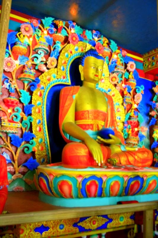
Beyond the surrounding
harsh, lunar landscape, notable sights at Dhankar Gompa includes a statue of
“Vairochana” (Dhayan Buddha) consisting of 4 figures seated back to back
in addition to various crumbling “Thankas”.

There is a small museum in
the gompa. In 2006, “World Monuments Fund” selected “Dhankar Gompa” as
one of the 100 most endangered sites in the world. A nonprofit group,
“Dhangkar” Initiative, is attempting to organize its conservation.
History:---
“Dhankar” was the traditional capital of the
“Spiti Valley Kingdom” during the 17th century and has some features dating
back to the 12th century. It was the seat of the early rulers of Spiti, the
“NONOS”, who had the right to cultivate the government lands nearby and were
required to keep the fort in repair. They also dispensed justice to the people
and were noted for their harsh penalties until the British replaced them.
.jpg)

The monastery is also
referred to as “Lha-'od-pai-dgon-pa”. "Lha-'od” seems to be the
local pronunciation of “Zla-'od”, the name of a famous Lama who was born
in 1121, according to the “Reu-mig”. “Zla-'od-pa” would then mean "a
follower of Zla-'od." He is apparently the founder or renovator of the
monastery which now belongs to the “Gelugpa” order. The monks assert that
it was not only of earlier origin than the “Tabo” Monastery, but also earlier
than “Srong-btsan-sgam-po”. They have, however, nothing to show of any really
ancient relics. They explain this fact by stating that the monastery was
plundered many times, lastly during the “Dōgrā” war.

It was worth visiting this
monastery. There are many fascinating terrace houses those are built at
different levels, which add to the Beauty of the Monastery. Just to freshen up
we took a little break and we ate little bit of refreshment and fruits. Then we
drove bak to “Shichilling” village, to continue to our further journey to “Pin
Valley”.
While driving from “Tabo” to “Kaza” on the way we have to pass through few small villages which come one after another in a sequence, such as “Shichling” that has a population of only (90), next one is “Lingti” that has a population of only (60), next one is “Lakhang” which has a small power generating hydral project that generates only (2X200) KW. It has a population of only (30) and then next one is “Lidang” that has a population of only (150). This is just to show how thinly populated these villages of “Spiti” valley are.
While driving from “Tabo” to “Kaza” on the way we have to pass through few small villages which come one after another in a sequence, such as “Shichling” that has a population of only (90), next one is “Lingti” that has a population of only (60), next one is “Lakhang” which has a small power generating hydral project that generates only (2X200) KW. It has a population of only (30) and then next one is “Lidang” that has a population of only (150). This is just to show how thinly populated these villages of “Spiti” valley are.
 |
| Distant view of “Shichling” village. |

 |
| The only connectivity of Shichling village and main road is through the Rope-way chair trolley |

PIN Valley
It is situated at an altitude of (8,450 ft) above MSL.
It’s approximate population
is (200)


To go to “Pin” valley, there
is a detour on the Left side of the main ““Shichilling - Kaza” road. Just 10
Km before reaching “Kaza” town from “Dhinkar Gompa”, on Left side of the road,
we had to cross one Huge Steel Bridge, which is erected on top of confluence of river “Spiti” and river Pin. This steel bridge connects “Pin Valley” with the main Kaza road. Once we crossed the bridge,
the road to “PIN” village is a constant
steep gradient climbing upwards with plenty of patches of deplorable bad narrow road.


The nearest town is “Gulling”
which is situated at (12,193 ft) above MSL. It has the largest population in the
region with about 200 people. With its sub-zero temperatures and semi-frozen
rivers, Pin Valley is the only “cold desert National Park” located in Himachal
Pradesh. The park lies in the valley of the Pin river, from where it derives
its name. Spreading south of Dhankar in the Spiti district near the Tibetan
border, the reserve forms a natural interface between the Lahaul and Spiti
divisions of the state. It was set up to protect and preserve the rare and
unique Himalayan flora and fauna. Vast and sparsely populated, Pin Valley is
home to 'the grey ghost of the Himalayas', the snow leopard, and its prey, the
ibex. Set against a back-drop of awe-inspiring icy mountain ranges, Pin Valley
is snowed in for a good part of the year and a trek to this fascinating country
should only be attempted by the spirited, adventurous and fit. The region is
also under strong religious influence with some very famous Buddhist
monasteries or Gompas located here.
 |
| Main entrance to Kungari Gompa. |
 |
| Inner sanctum sanctorum of the Kungari Gompa. |
 |
| Because of seepage, faded Paintings of Buddha in different manifestations. |
 |
| Dalai Lama's abode when he performed "Kalchakara" here at Pin village |
 |
| Meditating Buddha. |
 |
| Buddha in vibrant colours. |
 |
| Wheel of Life |
 |
| Depicting Buddhist mythology in vibrant colours |
 |
| Old Temple on left side of the Gompa |
Best season
The climate is dry with
freezing, high-velocity winds and minimal rainfall. Winter sets in early and
temperatures can drop to as low as (-35C). Heavy snowfall makes it risky to
visit the park from late December to March. The summer season lasts from late
May to September when temperatures reach a maximum of (25C), though the nights
may still be freezing. July to October is when the park is accessible. The
month of August is the ‘best time’ to visit Pin Valley, when the temperatures
are most hospitable, at least during the day! Botanists and zoologists would also
find July-August exciting.
Accommodations
This is mainly land for
trekking and camping hence traditional accommodation is limited. Bunkers
provided by the Forest Department are another option. The Buddhist monks are
very hospitable and could invite travellers to a cup of buttery, salty tea, or
perhaps a stay overnight at the Kungri monastery. Villagers in the valley are
also generous in providing shelter and food.
On Foot
Two main trekking
routes are available between mid-July and late September. One option is the
route from Kulu in the West, via the Pin Parvati Pass (11,639 ft). An
alternative route is from Kinnaur in the South via the “Bhaba” valley and “Tari Khango Pass” (11,100 ft).
Trekking at these heights is a fascinating experience. Spiti is full of
jhullas, like the rope bridge across the Parahio river, a tributary of the
Spiti where one crosses a steel wire rope of 12 mm. suspended from abutments on
both sides. Using a rope made of yak hair (that is tied around one's legs with
special knots) one can crawl across. With your heart in your mouth, you can't
help but marvel at the towering snow peaks with glaciers and the river coursing
beneath. There is a relatively new bridge from Attargo village to Pin Valley.
Local guides, porters and the famous Chhumurti horses are available for hire.
Pack mules and donkeys are also available.
Pin Valley National Park
It is
the only National Park in Himachal Pradesh which is situated in the cold desert
area. The park covering an area of 675 sq km as core zone and 1150 km as buffer
zone.
There are about 17
villages situated in the periphery of the park with a total population of about
1600 people. Besides this there are about 17 Dogharies (Summer settlements)
with some cultivation inside the park. These Dogharies are used as summer
residences by these people. The local residents in the whole Pin Valley conists
of scheduled tribes belonging to Buddhist community. There is a famous Gompa in
the Kungri vilage which is situated on the buffer zone of this park. The Chham
dance and Buchen dance by the Lamas of this Gompa are very famous dances in the
valley.


KAZA TOWN
Kaza is situated at an
altitude of nearly (12,000ft) above MSL
You can get the view of Kaza
two 2 KM before from the main entrance road. Kaza is the District Head Quarters
of Lahul Spiti Valley. The town has all the amenities and a Petrol Bunk that is
situated at the highest Altitude of the world at (12,000 ft) above MSL.


By the time we reached
“Kaza” town, it was nearly 4.30 in the evening. The weather was cloudy and lot
of tourists have reached before us.So almost all the hotels of the town were
full. Somehow we managed to check in a small budget hotel, Hotel “Tashal Delek”,
where after bargaining we had to Pay Rs. 400/- per night. The room was nice and
with TV facility. Kaza has a power cut problem and very low voltage. We could
not charge our camera batteries or the “Mobile phone handsets” during our whole
stay.

 |
| Pictures of main market of Kaza town |
 |
| View of Hotel where we stayed |
Kaza, Spiti Valley Himachal
Pradesh Spiti, locally pronounced “Piti”, is bounded on its south and west
by the valleys of Kulu and Lahaul; the region of Ladakh lies to the north and
the Kalpa valley lies to the south-east. Geologically and archaeologically,
Spiti is a living museum. The mountains are devoid of any vegetation and
erosion by wind, sun and snow over thousands of years has laid bare the rocks.
The rugged and rocky mountain slopes sweep down to the riverbeds giving the
landscape a moon-like appearance. Kaza is the capital of Spiti Valley.


The town of Kaza, is
the sub divisional headquarters of the “Spiti” Valley in the “Lahaul and
Spiti” district. It is the largest township and commercial centre of the
valley. The town is divided into the old, as “Kaza Khas” and new as “Kaza Somasections”. The new town contains the administrative buildings.
The “Tangyud” (Tang-rGyud) Gompa dates to the early 14th century and is built like a fortified castle with massive slanted mud walls and battlements with vertical red ochre and white vertical stripes. It is on the edge of a deep canyon and overlooking the town of Kaza, 4 km from the town. Approaching it from the south one, sees Kyu-ling (Skyid-gling), the stately palace of the Nono (king) on the other side of the river.


Access
Kaza is overlooked by high
mountain ridges on all sides. It has two access points : one from Kinnaur
valley and the other from the Lahaul valley, 11 km from
“Ki-Monastery” , the famous “Gelugpa” establishment. The route
through “Kinnaur” is open throughout the year, except for occasional short
periods resulting from landslides or heavy snowfall. This road, starting from
Shimla , follows the Sutlej river unto a little beyond Reckong
Peo, thereafter turning northwards to follow the Spiti river all the way to
Kaza.


The other road starts from Manali and after crossing the (13,090-ft)
high Rohtang Pass” to reach “Gramphoo” where it joins the road from “Keylong”
and proceeds south along Chandra River till Batal then climbs up to cross the (14,928-ft)
high Kunzum pass, enters the Spiti valley to reach Kaza. It remains closed
during winter months, normally from October end to June due to heavy snowfall
on both the passes. Kaza is among the coldest place in India. The
temperature varies greatly in a different seasons and during a day, January is
the coldest period of a year with an average temperature of (-37°C),while the
July is hottest month with an average temperature of (13°C).


 |
| Kaza Monastery near Pertol Bunk @ Kaza |
Tourism
Kaza is known for its avourite festivals and
the ancient “Sakya”. “Tangyud Monastery” in a side valley, 4 km from
the town. It is also popular with tourists and adventure seekers during summer
months because of its central location and connections to rest of the valley and
outside. This central location also makes Kaza an ideal base camp for trekking,
mountaineering and tours directed to other parts of the valley.Some of the
major tourist attractions in and around Kaza beside Tangyud Monastery are the
Key Gompa, Kibber village at an elevation of 4205 Mtrs. Above MSL,Gette Village
at an altitude of 4270 Mtrs. Above MSL,Langza village famous for presents of
marine fossils, the Pin Valley National Park, a protected area for avourite
high altitude wildlife and the Losar village 60 km to the north of Kaza at
an altitude of 4079 Mtrs. Above MSL.

Please read this paragraph. It’s a very important note, no one should miss it
After
checking in the hotel and unloading the luggage from our car, we ventured out to expolre
Kaza town. While we were roaming around Kaza town, we met couple of localities
who as usual, just out of curiosity inquired from us where were heading to.
Then the same monolog dilog by the localities started scaring us
that our “Mosquito size car-ALTO” wouldn't be able to reach us in one piece to Leh
via Kunzum La pass and the most notorious 3-Nalas, called as (1)—“Chooti
Dhara” (meaning small stream), (2)---“Badhi Dhara” (meaning bigger stream) and
(3)---“Pagal Nala (meaning the unperdictive Mad-Stream). All of the local inhabitants scared us so much that we didn’t know
what to do. Every single person suggested, "it was better that we go back to
Shimla and then from there take the route for Leh, Ladakh via Kullu, Manali,
Rohtang Pass, Kelong etc". That means we had to go back about more than 600 km
to reach Shimla and then to take another 359 Km to reach via Kulu, Manali road. Listening to these negative suggestions from the Locals, Guruduth’s and My mind
stopped working or thinking. Both of us went in to stressful depression. We didn't know whom to listen or what to do? Not
even a single person suggested or encouraged us that we could make it. We really got freaked out
and dreadfully scared.
We
two (Guruduth and myself), just sat down, sipped couples of cups of piping “Hot
Lemo-Tea” and tried hard to relax. Then after a while, just two of us planned..
Our Plan “A” was that we would hire a lorry, load our car into that lorry and that would reach us right upto Gramroo village by crossing all the hurdles of Kunzum La Pass, as well as three natourious Nalas.
Then the Plan “B” was that we would hire a local experienced driver, who would be familiar with those treacherous roads. And by his driving experience, he may reach us stately to Grampoo village, crossing all the hurdles of this treacherous road.
Plan
“A” didn’t work, because all the lorries who were going back via Grampoo
village were over booked to carry loads of pereciable “Green Peas”. Since it was Green Peas peak season. So no empty lorries were available.
Then
some how we managed to hire, supposed to be an expert youthful looking local driver. His name
was Sunny. He was young and seemed quite a confident driver. But since we
didn’t know how good driver he was? We requested him to come, the next day morning
and drive us to sight seeing trip around Kaza monasteries.
Next day morning
promptely at 8 AM, he reported at our hotel and drove us towards Kibber
village. We observed that his driving was so, so. He was too unsteady. Some how he managed to reach us up to Kibber village.
Next he was supposed to be taking us on more tougher terrain of deplorable road
towards Komic Monastery and Hakim Monastery. Those roads would have been a real test of
his driving skill. While returning back from Kibber, suddenly he stopped the car and
talked to some one on his Mobile phone. Then he again sat in the car and told us
that his father got siddenly very sick, (who lived in Pin valley). So he had to go back to
Kaza, and could not come with us at least for that particular day. He drove us back to Kaza and disappeared
and never came back. Though he had promised that next day he would definitely
come to drive us to safety across Kunzum La Pass. So, that was the end of our Plan “B” too.
Now we were left with no choice, either we turn back and take Shimla, Kulu, Manali, Rohtang, Keylong road or I drive myself on this treacherous road and face the dreadful consequences, whichever may come across while driving through Kunzum La Pass and those dreadful notorious three Nalas. Our situation was some thing like, as they say “SO NEAR, YET SO FAR AWAY”. Anyway in these horrible situations, we both were terribly depressed, frustrated, discouraged, dejected, upset and had practically endless nightmares. We didn’t know in this uncertainty what to do? After hours of brain storming and weighing all the probabilities and possibilities, we took a decision that come what may, since we had taken all the risks of reaching till Kaza. With positive attitude and self-confidence, I decided that come what may, I would take the dare devil risk of driving our “Small Mosquito ALTO” on those gigantic towering mountainous treacherous terrains and unpredective “notorious “Nalas”. Now I was confident that our ALTO car would save us and herself (I mean the Alto car) from the merciless onslaught of “Kaza to “Grampoo” “Hell Road”
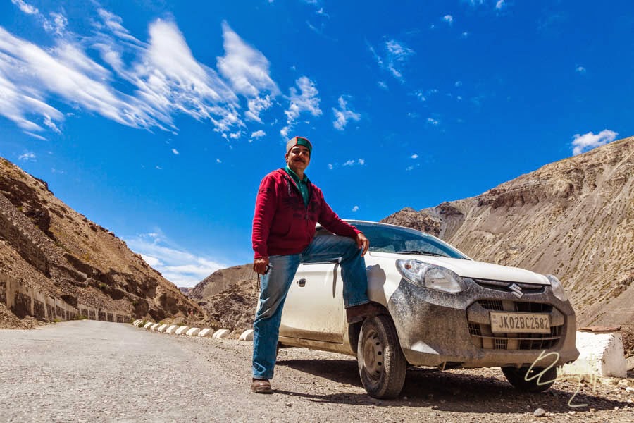
Anyway we made up our minds to self-drive our car towards Leh via Kunzum La Pass.
A
Now we were left with no choice, either we turn back and take Shimla, Kulu, Manali, Rohtang, Keylong road or I drive myself on this treacherous road and face the dreadful consequences, whichever may come across while driving through Kunzum La Pass and those dreadful notorious three Nalas. Our situation was some thing like, as they say “SO NEAR, YET SO FAR AWAY”. Anyway in these horrible situations, we both were terribly depressed, frustrated, discouraged, dejected, upset and had practically endless nightmares. We didn’t know in this uncertainty what to do? After hours of brain storming and weighing all the probabilities and possibilities, we took a decision that come what may, since we had taken all the risks of reaching till Kaza. With positive attitude and self-confidence, I decided that come what may, I would take the dare devil risk of driving our “Small Mosquito ALTO” on those gigantic towering mountainous treacherous terrains and unpredective “notorious “Nalas”. Now I was confident that our ALTO car would save us and herself (I mean the Alto car) from the merciless onslaught of “Kaza to “Grampoo” “Hell Road”
Anyway we made up our minds to self-drive our car towards Leh via Kunzum La Pass.
A
“Grit is having the courage to push through, no matter what the obstacles are, because it’s worth it.”as truly said and you carry it with determination and unflinching resolve Baiji
ReplyDelete